Site layout and design
Our planning application will be for Outline Planning, which means it is establishing the principle to develop 32 homes on the site, 11 of which will be affordable.
The application will not include any details on layout or design, these are dealt with at a later stage, at which time you will be able to comment on these aspects.
The layout and designs shown here are illustrative, intended to give you a feel for what the proposed level of development on the site would look like, so that you are able to give you views on the principal of developing 32 homes on the site.
Site constraints
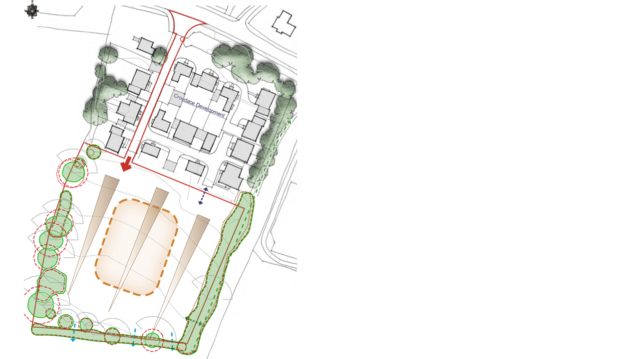
The constraints plan shows the existing site features which will inform and restrict the layout of the proposed scheme. These are:
Relationship of the site to existing Woodlands Close development.
A safe and adequate access, road alignment and entrance location.
Existing boundary trees and vegetation and associated Root Protection areas.
Topography of the site- sloping from north to south.
Restricted views into the site from the surrounding area.
Need to respond to the character, local heritage and appearance of the surrounding neighbourhood.
Need to consider the orientation and outlook of the new dwellings in terms of their surroundings and the shade from retained trees.


Site layout
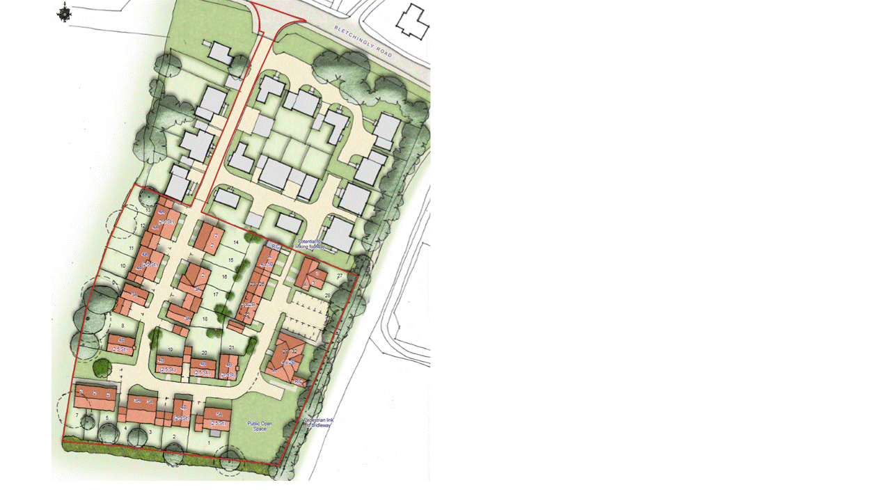
This is an illustrative layout for the proposed new homes. It aims to create a very similar look and feel to the current Woodlands Close. The key features of this design are:
32 new homes to help meet local needs.
A high quality and sustainable development with good access to local facilities.
11 new affordable homes.
Retention and enhancement of all boundary trees and hedgerows.
Helping the wider regeneration of Merstham.
Creating a new public open space in South East corner with direct link to bridleway and nature reserve beyond.
Minimising visual impact on the surrounding countryside
Street elevations
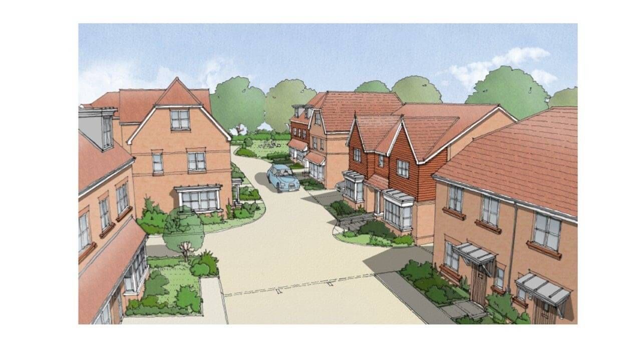
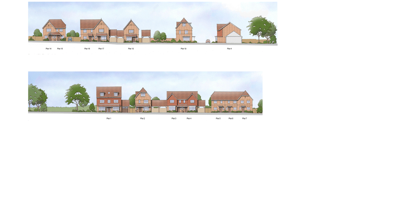
These images illustrate the street elevations you may see as you pass through the developed site.
It is likely that the development will be similar in feel to the existing Woodlands Close.
The site slopes from north to south and incorporates a new public space in the corner nearest the Nature Reserve- visible at the end of the road in the image opposite.


